Tony Bowerman enthuses about Wirral’s varied coast – wildlife, offshore islands and boundless salt marsh
THE ENGLAND COAST PATH HOPS down the pleasant coastline of Wirral between the vibrant city of Liverpool and the northern end of the Wales Coast Path, just outside the walled city of Chester.
It’s an interesting and varied stretch. Apart from a few minor refinements to the route to take it even closer to the water, the England Coast Path will follow existing, already well-established coastal public rights of way from Birkenhead’s Seacombe ferry terminal down to the Welsh/English border just outside Chester.


Wirral is a distinctive, 15 by 7 miles/24 by 11 kilometres roughly rectangular peninsula wedged between Liverpool and Chester in northwest England. Surrounded on three sides by the broad Dee Estuary, the busy Mersey and the Irish Sea, it sometimes feels a bit like an island.
Better still, all that lovely, open coast gives Wirral a breezy, salty seaside atmosphere. Lovely for long-distance walking. And just the job, too, for bracing coastal and beach walks, easy, level off-road cycling, jogging, dog walking, horse-riding, birdwatching, dawdling, daydreaming, picnics, coastal pubs and café stops.
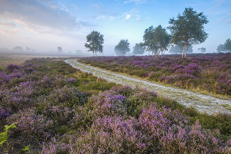
While the England Coast Path hugs the shore, Wirral also enjoys a network of more than 100 miles/160 km of traffic-free rights of way: dedicated cycleways, by-ways, bridleways and coastal footpaths — plus a wealth of other ‘permissive’ paths and publicly accessible routes. So, there’s plenty of scope for inland diversions and circular routes, too.
To reach Wirral from the north, catch one of the regular Mersey Ferries from Liverpool’s Pierhead to Seacombe, on Wirral. Once on the peninsula, turn right and head north, up the western bank of the Mersey. The New Brighton promenade is said to be the longest in Britain and overlooks the historic docks that line the opposite Liverpool shore at the entrance to the Mersey. Wirral’s north-eastern ‘corner’ was developed in the 1800s as a fashionable, upmarket residential area styled as a ‘New Brighton’. Today, it’s dominated by Perch Rock — a Georgian gunnery fort — and a sea-wrapped lighthouse, both built to guard the Mersey mouth.
Surrounded on three sides by the broad Dee Estuary, the busy Mersey and the Irish Sea, the Wirral peninsula sometimes feels a bit like an island.
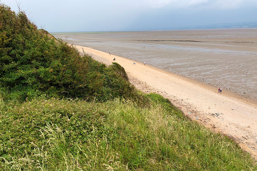
Wirral’s northern coast, on the England Coast Path
From here, the shoreside path heads west, along Wirral’s northern coast, bounded by the Irish Sea. There’s a marine lake, long sandy beaches and, just offshore, vast low-water sandbanks with evocative names like Mockbeggar Wharf and North Bank.
The coast path runs on along what was once a sandy shore, now edged by golf links, dune systems and the North Wirral Country Park. Next comes open Leasowe Common with its vertical white landmark, Leasowe Lighthouse.
The name of the next settlement, Meols, gives a clue to the coast’s original character: melr is an Old Norse or Viking word meaning ’sand dunes’. Soon after dredging began in the mouth of the Mersey in the early 1800s, all sorts of ancient artefacts started to emerge from the shore. They included Iron Age, Roman, Anglo-Saxon and Viking coins, brooches, weapons, tools, keys, and pottery. Many of these artefacts can be seen today in the Museum of Liverpool. Off Dove Point are the remains of a fossilised forest, now covered by the shifting sands again. Even more surprising was the discovery in 2007 of a clinker-built Viking trading ship buried some 2-3 metres beneath a pub car park at Meols. It seems that the tip of Wirral was an important port and trading hub for several thousand years, long before the rise of first Chester and then Liverpool.
Today, a recreational cycleway and path run all along the north Wirral shore, now protected from the Irish Sea by sculptural breakwaters and an embankment. It’s an open coast, dominated by the sea, the sky and the cry of gulls. Offshore, far out in Liverpool Bay, ghostly white wind farms shift in the haze.
Islands in the tide …
Wirral’s north-west corner is marked by Hilbre Point, aptly-named Red Rocks and the three sandstone islets that make up Hilbre Island, a curious nature reserve crouching in the mouth of the broad Dee Estuary. There are breeding rare Natterjack toads in the dunes and marshes at Red Rocks, while Hilbre hosts thousands of crowded waders at high tide, and fat grey seals haul out on the offshore sandbanks at low tide. It’s said the sandbanks are covered in shells of two types: sea shells and countless spent anti-aircraft gun shells fired at enemy bombers heading for Liverpool docks during the Second World War.
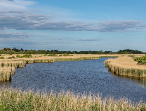
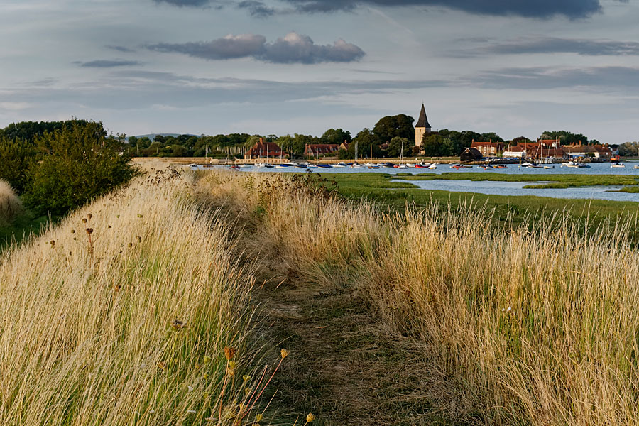
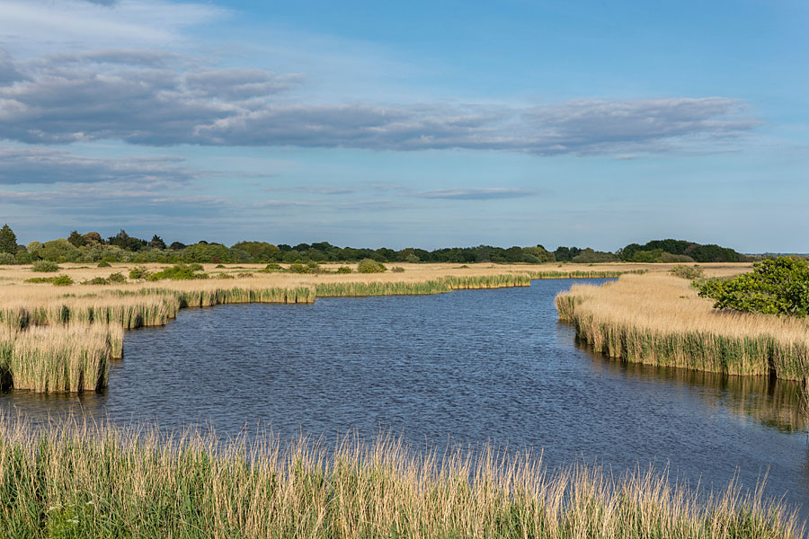
From West Kirby with its Marine Lake, ice creams, promenade and exotic palm tree-fringed parks, the path heads south towards Chester. Suddenly, the path takes on a different character. Now running along the broad Dee Estuary, fringed with salt marsh and inky channels, overlooking Wales on the far shore, the path seems gentler and more intimate. There are trees and marsh plants. The dominant colours have changed from jade-green seas and orange sands to muddy greys and vibrant greens. And, far out on the other side, the distant Welsh hills.
Key routes down the Dee shore include the Wirral Way, a 12 mile/20 kilometres-long former railway line that’s now a popular cycling, walking and horse-riding route between West Kirby and Hooton. Although the old railway runs just inland, there are other paths and cycleways that trace the shore close to the tideline. Together, they provide plenty of opportunities for circular routes, too – out along the marshes and back along the Wirral Way.
Beyond the Wirral Country Park at Thurstaston, with its clay cliffs, stunning views, picnic tables, and sandy shore, the Wirral Way runs on below Heswall to Parkgate – whose sea wall-lined main street overlooks the marsh. Old photographs show local boats landing cockles at the middle slipway here as late as the 1940s; now, the saltmarsh encroaches on the sea wall and floods only during the highest ‘spring’ tides. Today, Parkgate is famous for its local potted shrimps, ice creams, cafes, chip shop and eateries.
Beyond Parkgate, the Wirral Way veers away from the shore towards its terminus at Hooton. But the shoreside path continues below Neston, passing the remote Harp Inn beside the ruins of the old Neston Quay. Now a lane and cycleway, the shoreside path runs on alongside the RSPB’s Burton Marsh Reserve to reach Burton Point and its Iron Age earthworks that once guarded the old course of the River Dee before it was diverted over to the Welsh shore. From here, the new Burton Greenway carries walkers and cyclists along a broad tarmac and boardwalk route on through the Deeside Industrial Park, into Chester.
All in all, the coastal route around the Wirral shore from Liverpool to Chester is a delight. Varied, bracing and with ever-changing views, this is part of the England Coast Path not to be missed.

Tony Bowerman
This article is published here with the author’s permission. Copyright © Tony Bowerman 2021. All rights reserved.
Tony Bowerman is a director of Northern Eye Books Ltd, and loves nature and the outdoors. At one time he contributed articles to several national newspapers and magazines. He later worked as an ‘interpretation consultant’ for clients such as the National Trust, Welsh Water, County Councils and Wildlife Trusts. He is a member of the Outdoor Writers and Photographers Guild.
Books and maps for this part of the coast