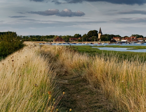
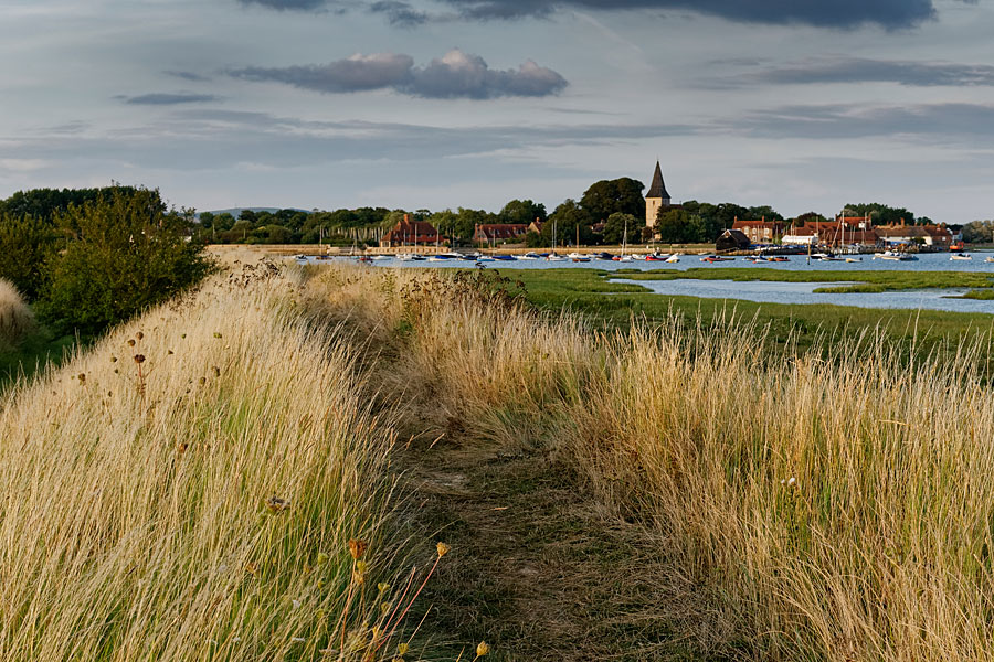
Roger Butler discovers unexpected silence and solitude amid the reeds and saltmarsh at Thorney Island, in West Sussex
IT LOOKS QUITE FLAT. It looks quite boring. It’s still called an island even though it was linked to the mainland in 1870. But there’s only one footpath, right round the perimeter, and the busy south coast traffic isn’t that far away. .
And to make matters worse, the map shows an army base and the star-shaped runways of an old aerodrome. This is Thorney Island and, believe it or not, it’s a great place for a walk with a wild and watery difference! And now it’s part of the growing England Coast Path
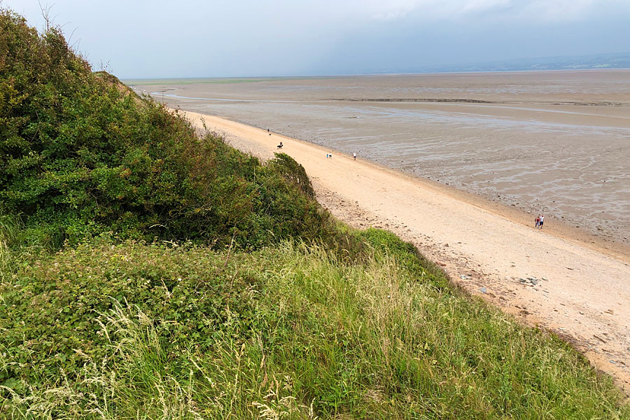
The rumble of traffic starts to disappear in the old port of Emsworth and the creeks and channels of Chichester Harbour spread south in expansive style. This is an Area of Outstanding Natural Beauty with few contours but lots of sea and sky and Thorney Island offers unexpected silence and solitude. The seven-mile stride around its circumference – strictly imposed because of the long-established military facilities – requires little in the way of map reading and the day’s only real decision is clockwise versus anti-clockwise. But don’t worry – there are no mesh fences or barbed wire. It’s just sand, shingle, shorebirds and space. And it’s a pretty amazing space, particularly given its proximity to the tightly packed streets in nearby Portsmouth.


The army’s presence is low-key but two gates, one of each side of the bulbous peninsula, guard access to the right of way. A simple buzzer automatically opens each of these, though a CCTV surveillance man is probably checking that your boots have been given their daily polish.
I opted to go anti-clockwise and was soon watching swirls of dunlin, tortoiseshell-striped shelducks and dazzling white egrets. Curlews evocatively called as they swept over the mud banks and nervous oystercatchers piped below the grass banks.
The empty coastline is surprisingly varied but the island keeps itself to itself. I looked east, across the wide mud banks of Thorney Channel, to the throngs of matchstick people on the sands at West Wittering and remembered that old equation: car park x easy access = crowded honeypot. There are no such problems on Thorney and the wide seascape, together with wetlands, fields and marshes, means you never feel constrained by the limits of the coastal path.
This is an Area of Outstanding Natural Beauty with few contours but lots of sea and sky and Thorney Island offers unexpected silence and solitude
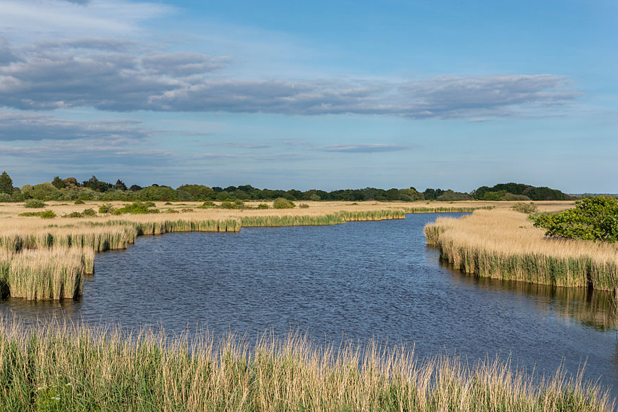
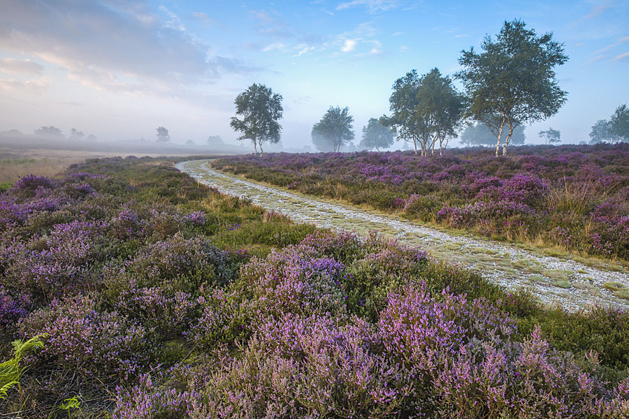
Watery landscape
The RSPB look after Pilsey Island down at the south-eastern tip, though this is rapidly becoming part of Thorney as deposition leaves increasing piles of pebbles and silt. Turning north, the character changed again as I walked above twisting inlets lined with fusty reeds, thick dripping moss and salty slime. Brent geese honked offshore and a red-breasted merganser dived for food. Pools of still water caught the reflections from an advancing mackerel sky, lit with wisps of rosy light as the sun started to sink behind the Isle of Wight. The South Downs rolled and rippled to the north as I pressed the second buzzer and crossed a wide and fast-flowing channel which is disturbingly called Great Deep.
Landscapes like this are in constant flux, particularly at a time of rising sea levels. The army promote habitat and conservation work across the island, but I can just imagine a discussion with the major about the possibilities for coastal retreat: “Retreat? Retreat! My regiment never retreats – you’d better call it something else!”
Roger Butler – author and OWPG member
This article first appeared in The Great Outdoors (TGO) magazine in Spring 2017, and is re-published here with the author’s permission. © Roger Butler 2020. All rights reserved.
Roger Butler is a geographer and landscape architect turned freelance writer, photographer and lecturer. He contributes to a wide range of magazines and lectures throughout the UK. His interests include hill walking, wildlife and the countryside, canals and industrial archaeology. He is a Fellow of the Royal Geographical Society, a Licentiate of the Royal Photographic Society and a Chartered Member of the Landscape Institute. He is also a member of the Outdoor Writers and Photographers Guild and is available for commissions and new projects.
Contact: roger522@btinternet.com
Books and maps for this part of the coast